New Map By Maltese Seismologist Reveals Thickness Of Earth’s Crust Across Mediterranean

A Maltese scientist and other international experts have just published a new map showing the thickness of the crust for the Central Mediterranean – including Malta.
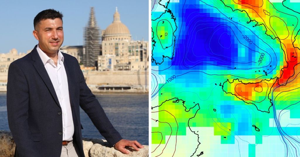
Matthew Agius, a seismologist at the Department of Geosciences of the University of Malta, used data recorded over the past 25 years by hundreds of seismic stations across Italy, Libya, Tunisia, Greece and Malta to perform seismic tomography and map the crustal structure in the region.
The earth’s crust is typically 30 kilometres thick – but it does not have the same thickness everywhere.
The crust generally is thinner beneath the sea, such as throughout the Tyrrhenian Sea and the Sicily Channel and thicker beneath the mountains, such as the Maghrebian-Apennines mountain chains.
Now, the team’s high-resolution map provides new insight into the tectonics around us, particularly in identifying areas of crustal deformation.

The study reveals that beneath the Sicily Channel, between Malta, Lampedusa, Pantelleria and Sicily, two major Earth processes are taking place: the stretching and thinning of the crust, underlain by deeper mantle upwelling.
These processes explain the bathymetry of the Sicily Channel, characterised by valleys deeper than 1 kilometre.
This study was conducted in collaboration with scientists from Università Roma Tre and part of project GEOMED, which was funded by the European Union’s Horizon 2020 research and innovation program under the Marie Skłodowska-Curie grant agreement.
You can find an article on this topic published within the science journal Geochemistry, Geophysics, Geosystems by following this link.
Tag someone who needs to see this